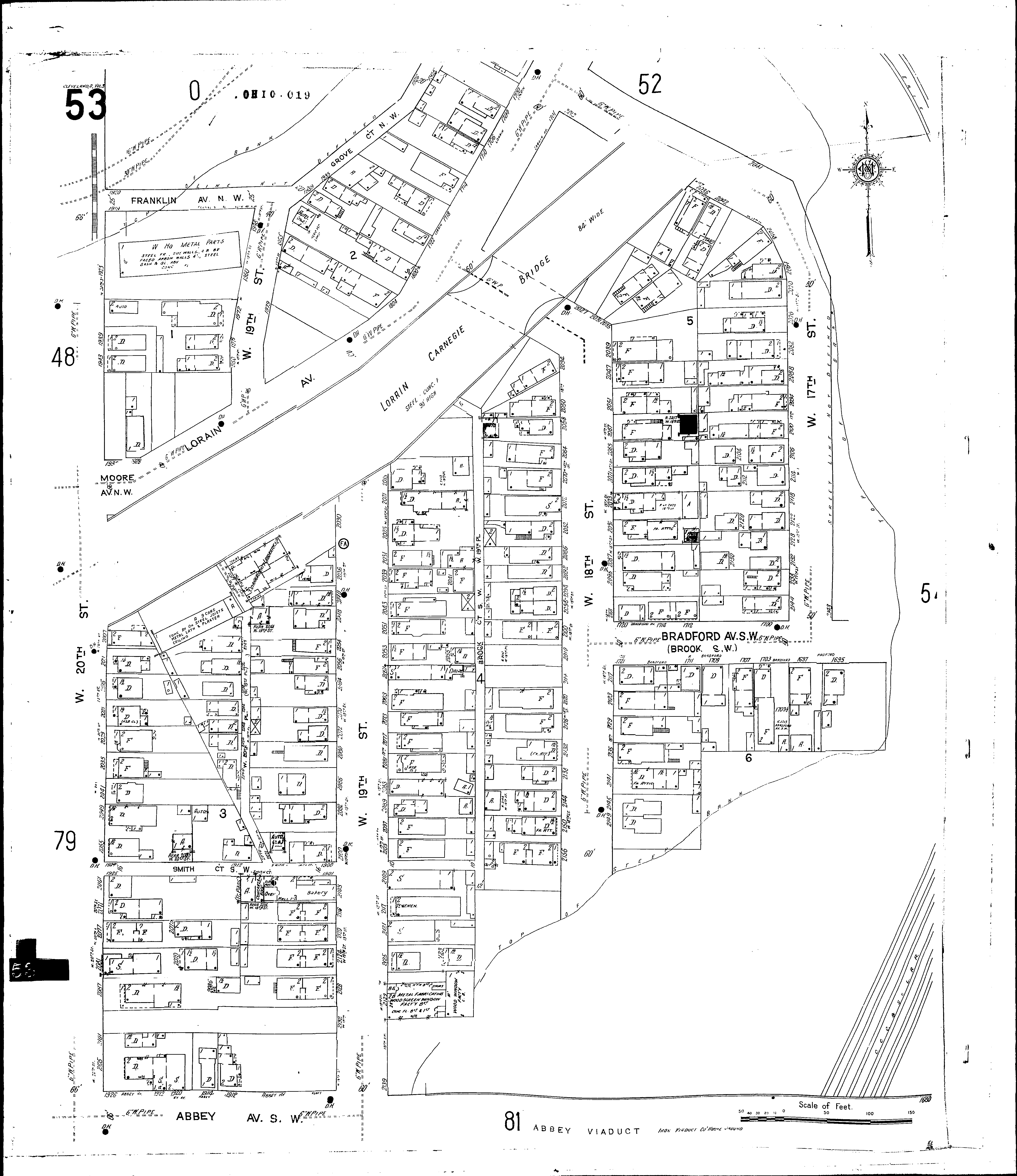
A full color archival version of this map is available from the Kent State University Institutional Repository.
Locations: County Laboratory
Streets: Abbey Ave. S. W [1680-1926] Bradford Ave. S. W [1695-1720] Brock Court S. W Brook S. W [1695-1720] Eighteenth St., W [2000-2161] Franklin Ave. N. W [1900-1921] Lorain Ave [1700-1935] Moore Ave. N. W [1928-1933] Nineteenth Place, W [2010-2109] Nineteenth St., W [1948-2139] Seventeenth St., W [2000-2012] Seventeenth St., W [2014-2145] Smith Court S. W [1900-1925] Smith Place S. W [2010-2109] Twentieth St., W [1971-2105]