County:
Montgomery Co.
City:
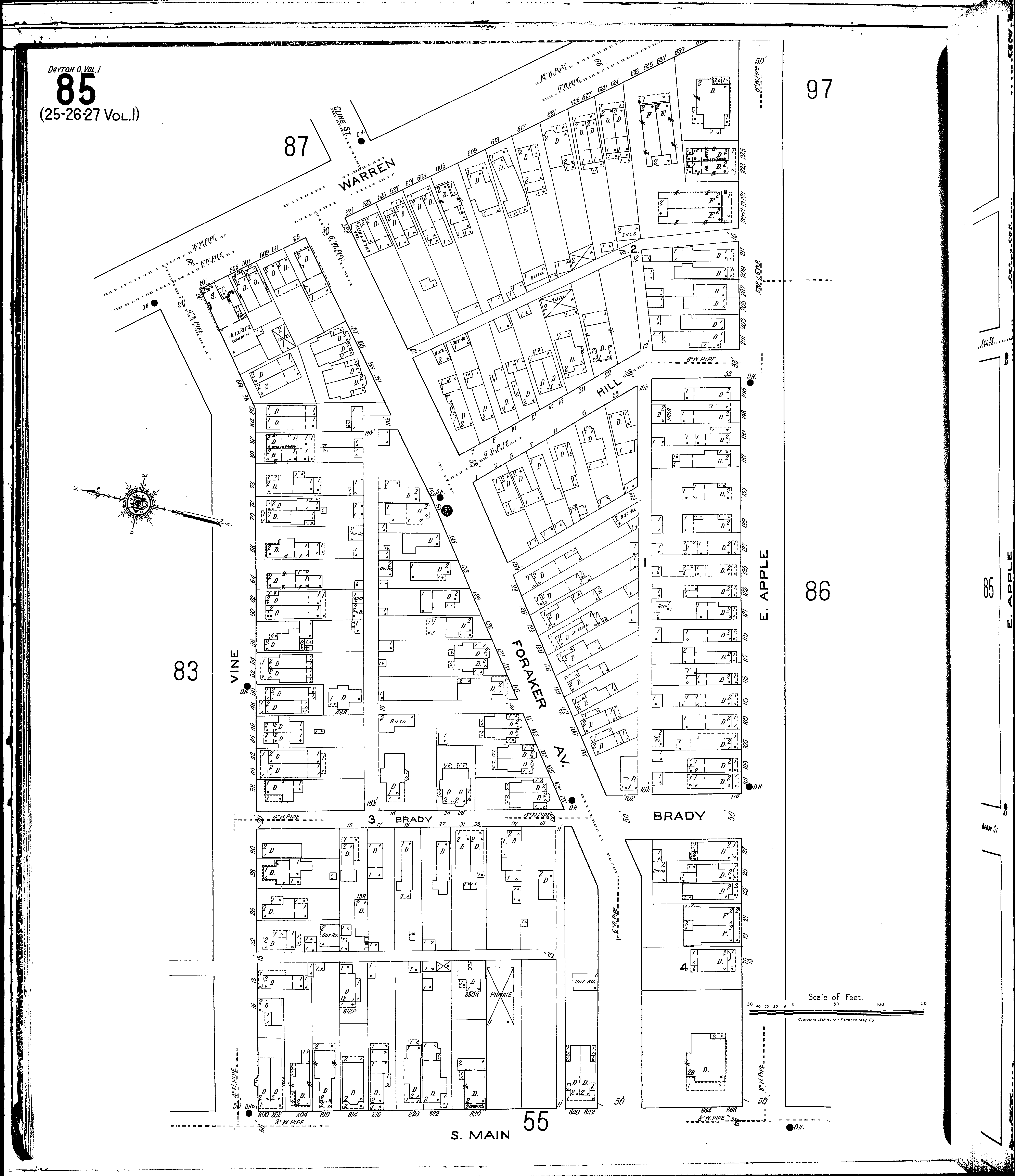
Dayton
Date:
1918-1932 vol. 1, 1918
Currently viewing image:
90 of 110
Previous
-
Next
Current sheet label:
85
Jump to sheet label:
Print map from PDF
Download full image
Download current view
A
full color archival version
of this map is available from the Kent State University Institutional Repository.
Streets:
Apple, E [1-235]
Brady [1-116]
Foraker Ave [1-228]
Hill [1-34]
Main, S [800-868]
Vine [2-96]
Warren [501-643]