County: Montgomery Co.
City: Dayton
Date: 1918-Dec. 1950 vol. 1, 1918-Oct. 1950
Currently viewing image: 67 of 109
Previous -
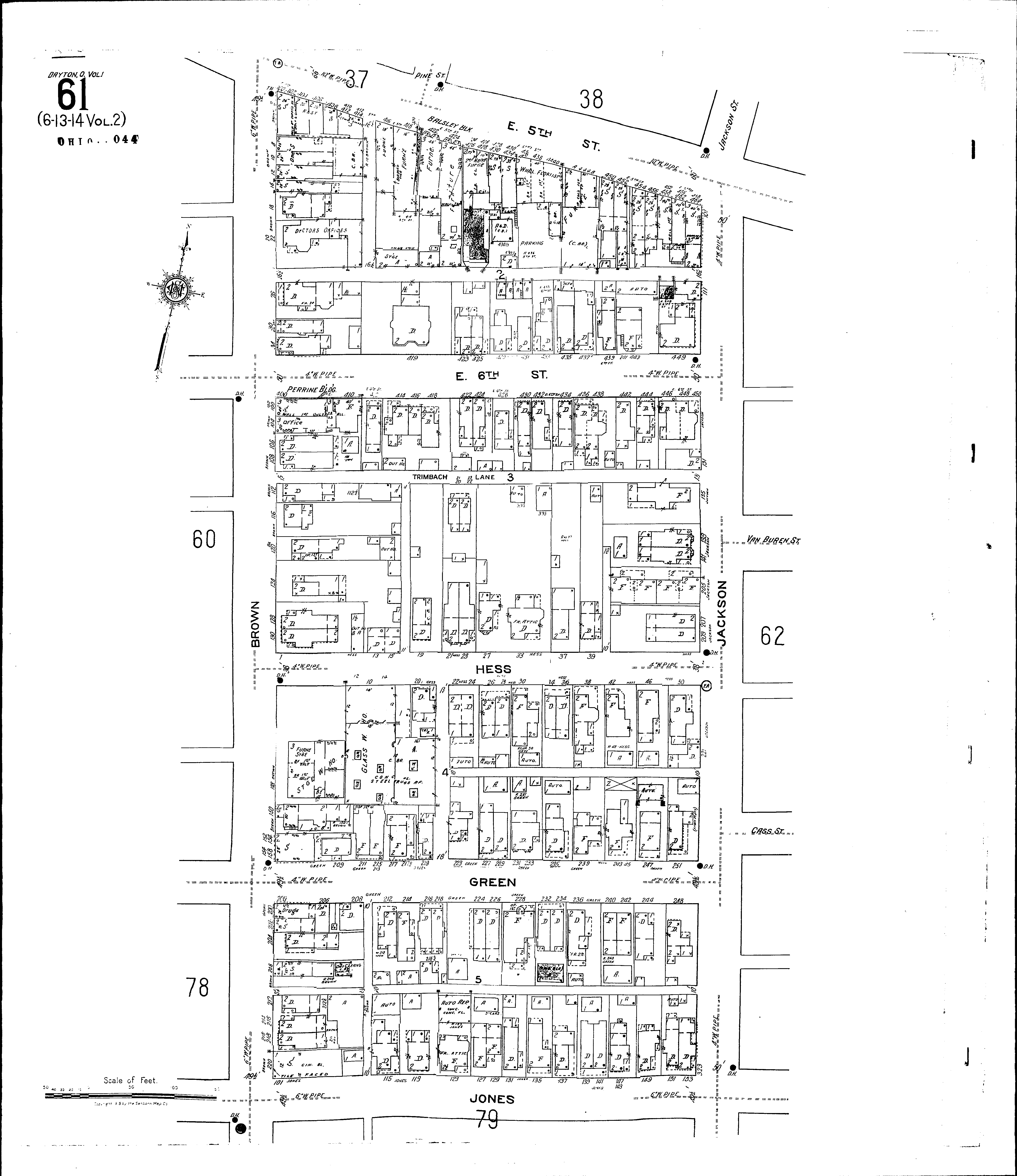
NextCurrent sheet label: 61
Jump to sheet label:
Print map from PDF
Download full image
Download current view
A
full color archival version of this map is available from the Kent State University Institutional Repository.
Locations:Balsley Block
Perrine Building
Streets:Brown [2-224]
Fifth, E [400-460]
Green [200-255]
Hess [1-54]
Jackson [101-325]
Jones [101-155]
Sixth, E [400-455]
Trimbach Lane