County: Montgomery Co.
City: Dayton
Date: 1918-Dec. 1950 vol. 1, 1918-Oct. 1950
Currently viewing image: 80 of 109
Previous -
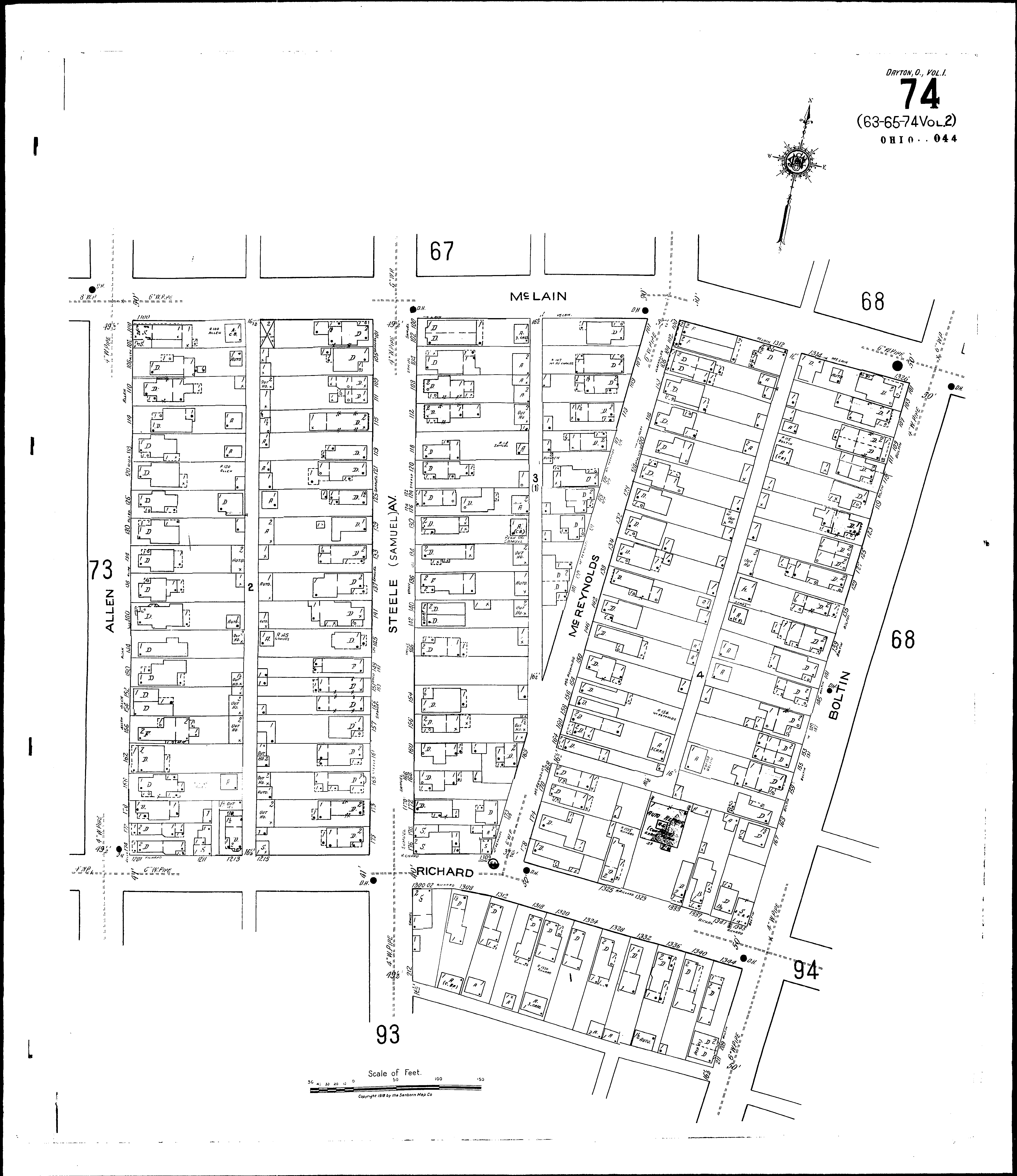
NextCurrent sheet label: 74
Jump to sheet label:
Print map from PDF
Download full image
Download current view
A
full color archival version of this map is available from the Kent State University Institutional Repository.
Streets:Allen [100-178]
Boltin [101-211]
McLain [1100-1328]
McReynolds [100-179]
Richard [1201-1225]
Richard [1300-1349]
Steele Ave [100-179]
Steele Ave [200-212]