A full color archival version of this map is available from the Kent State University Institutional Repository.
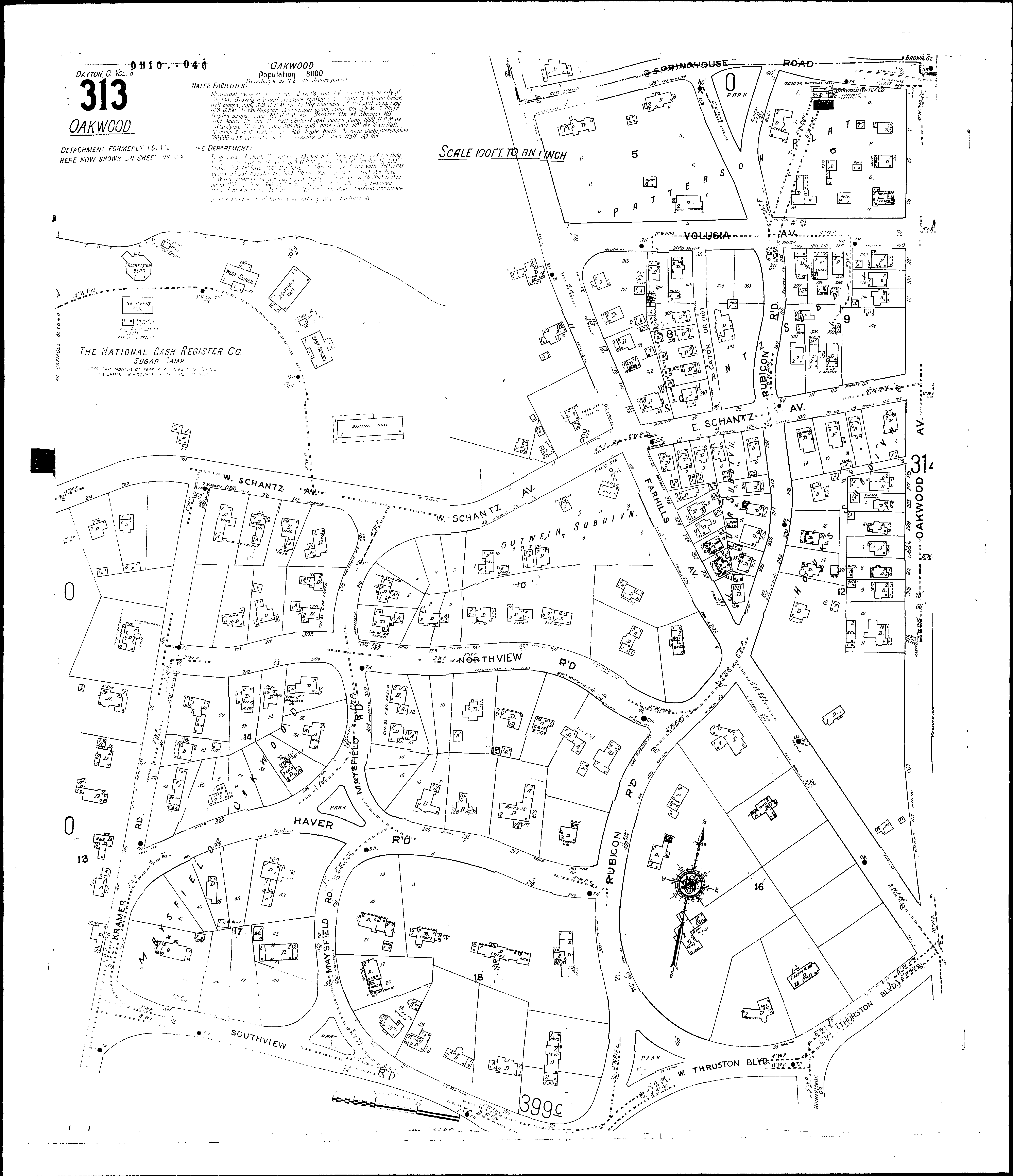
Locations: National Cash Register Co., Sugar Camp Farhills Apartments Oakwood Center Public School Oakwood Water and Light Co St. Pauls Episcopal Church
Streets: Caton Drive, at Oakwood Schantz Ave., W., at Oakwood [200-215] Thruston Blvd, W., at Oakwood Caton Road, at Oakwood Dixon Ave., W., at Oakwood [19-37] Dixon Ave., W., at Oakwood [38-139] Far Hills Ave., at Oakwood [1-360] Far Hills Ave., at Oakwood [550-699] Harmon Ave., at Oakwood [600-845] Harmon Terrace, at Oakwood Haver Road, at Oakwood [200-335] Kramer Road Kramer Road, at Oakwood Maysfield Road, at Oakwood Northview Road, at Oakwood Oakwood Ave., at Oakwood [1-525] Park Ave., at Oakwood Rubicon, Road, at Oakwood [1-550] Runnymede Road, at Oakwood Schantz Ave., E., at Oakwood [1-128] Schantz Ave., W., at Oakwood [1-160] Southview Road, at Oakwood [200-325] Springhouse Road Springhouse Road, at Oakwood Thurston Boulevard, at Oakwood Volusia Ave., at Oakwood [1-140]