A full color archival version of this map is available from the Kent State University Institutional Repository.
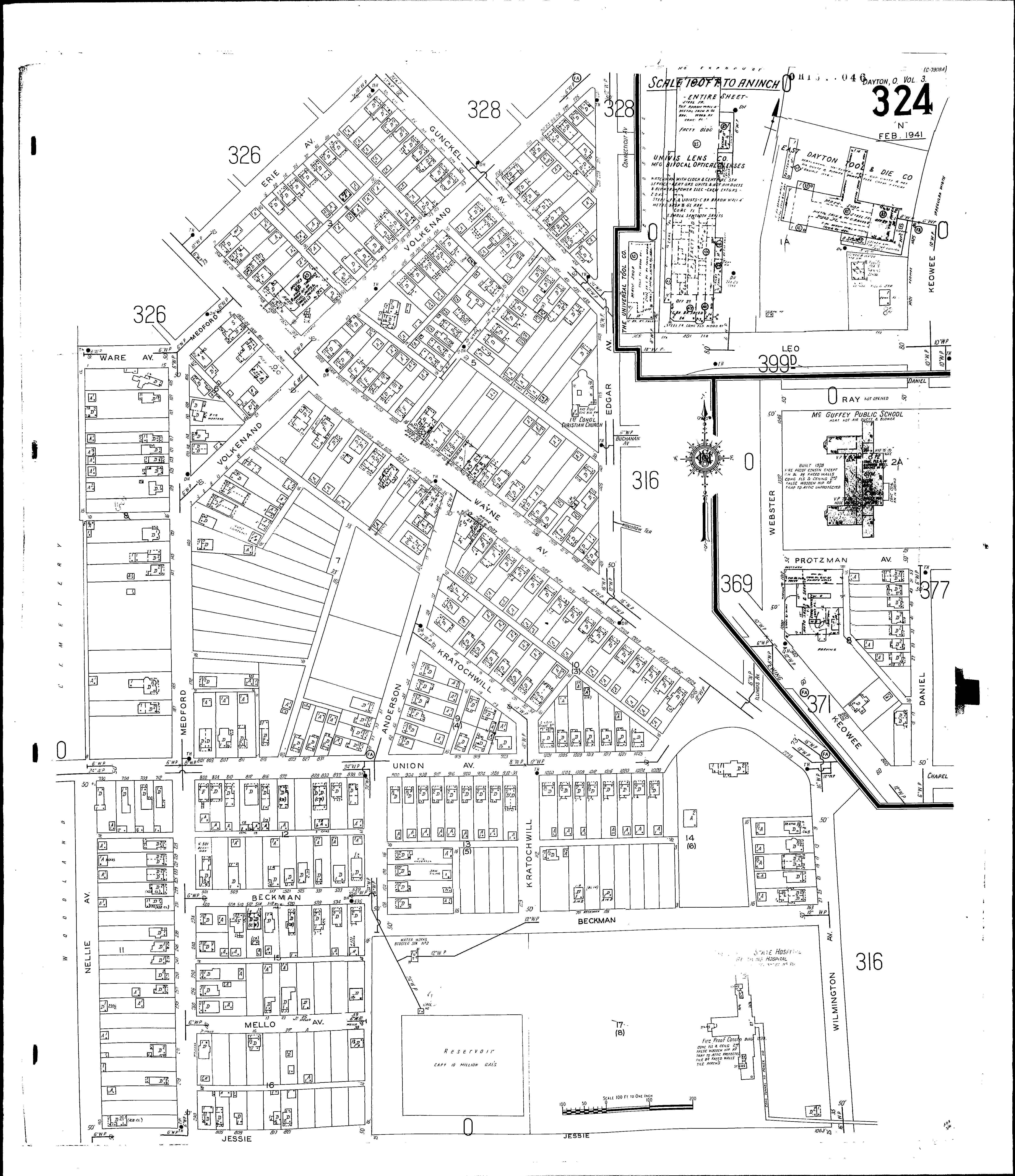
Locations: Dayton State Hospital, Receiving Hospital East Dayton Tool and Die Co First Congregational Christian Church McGuffey Public School Universal Tool Co Univis Lens Co McGuffey Elementary School
Streets: Daniel [1-53] Edgar Ave [201-431] Erie Ave [2-58] Gunckel Ave [301-335] Gunckel Ave [400-445] Jessie Keowee [800-840] Keowee [1401-1435] Kratochwill [1-124] Leo [N. S., W. of Keowee] Medford [2-14] Medford [100-295] Mello Ave Nellie Ave [1-90] Protzman Ave [1-26] Ray [S. S., E. of Webster] Union Ave [700-1045] Utah Court [1-46] Volkenand [1-154] Volkenand [200-228] Ware Ave [1-15] Wayne Ave [1900-2135] Wayne Ave [2201-2235] Beckman Protzman Ave [1-99] Ray [2-98] Union Ave [900-1049] Wayne Ave [2101-2265] Webster [1000-1064] Wilmington Ave [1-129]