A full color archival version of this map is available from the Kent State University Institutional Repository.
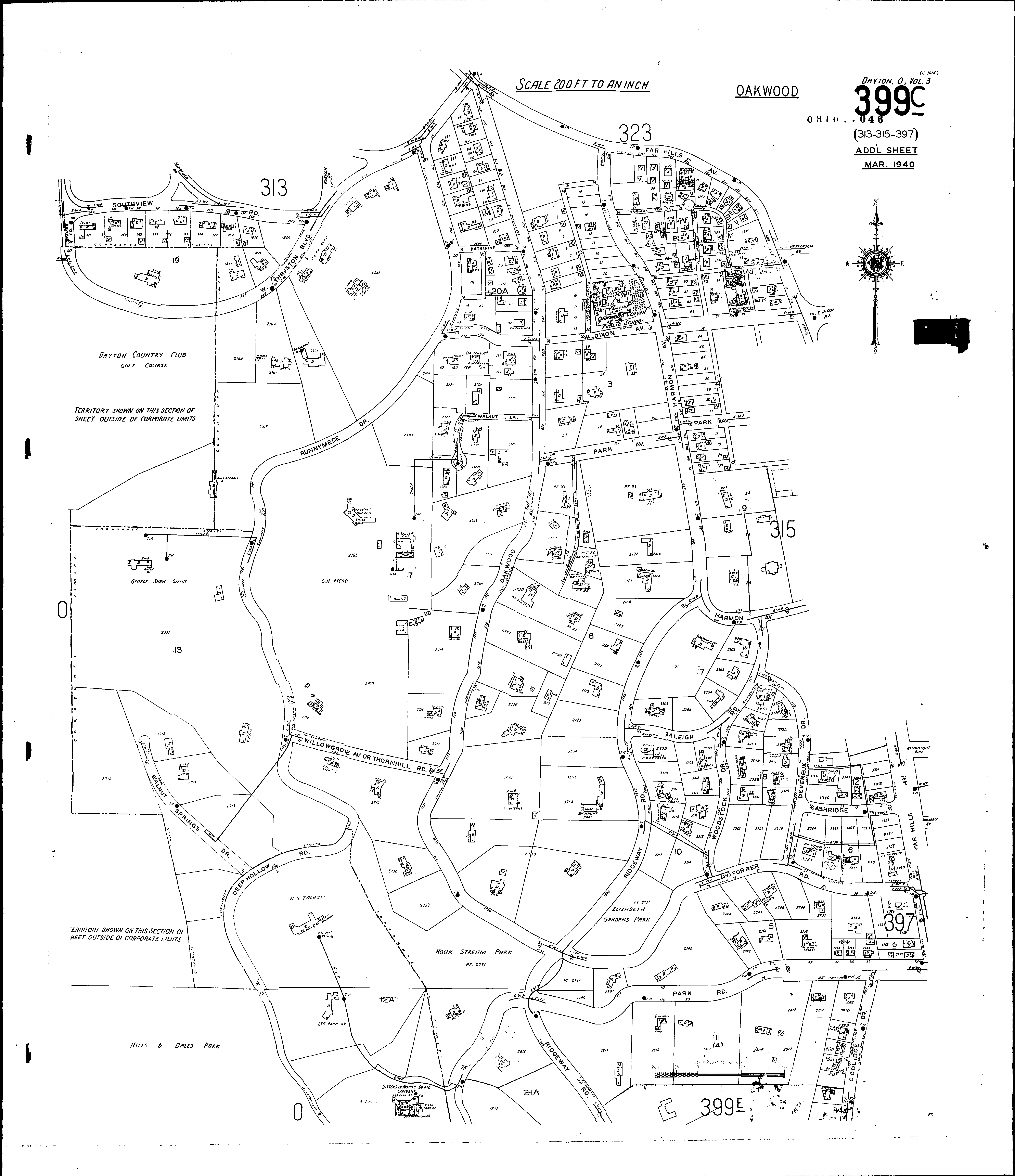
Locations: Oakwood Center Public School St. Pauls Episcopal Church
Streets: Ashridge, at Oakwood Briar Hill Road, at Oakwood Coolidge Drive, at Oakwood [1701-1819] Devereux Drive, at Oakwood [1300-1525] Dixon Ave., W., at Oakwood [1-37] Dixon Ave., W., at Oakwood [38-237] Far Hills Ave., at Oakwood [501-1629] Forrer Road [1-198] Harmon Ave., at Oakwood [600-1129] Harmon Terrace, at Oakwood Katherine at Oakwood Kramer Road, at Oakwood Oakwood Ave., at Oakwood [500-1295] Park Ave., at Oakwood [50-159] Park Road, at Oakwood [1-25] Park Road, at Oakwood [26-199] Park Road, at Oakwood [244-255] Ridgeway Road, at Oakwood [1100-2087] Runnymede Drive, at Oakwood Southview Road, at Oakwood [200-340] Thornhill Road, at Oakwood Thruston Blvd, at Oakwood Walnut Lane, at Oakwood Willowgrove Ave., at Oakwood Woodstock Drive, at Oakwood [1200-1519] Walnut Springs Drive