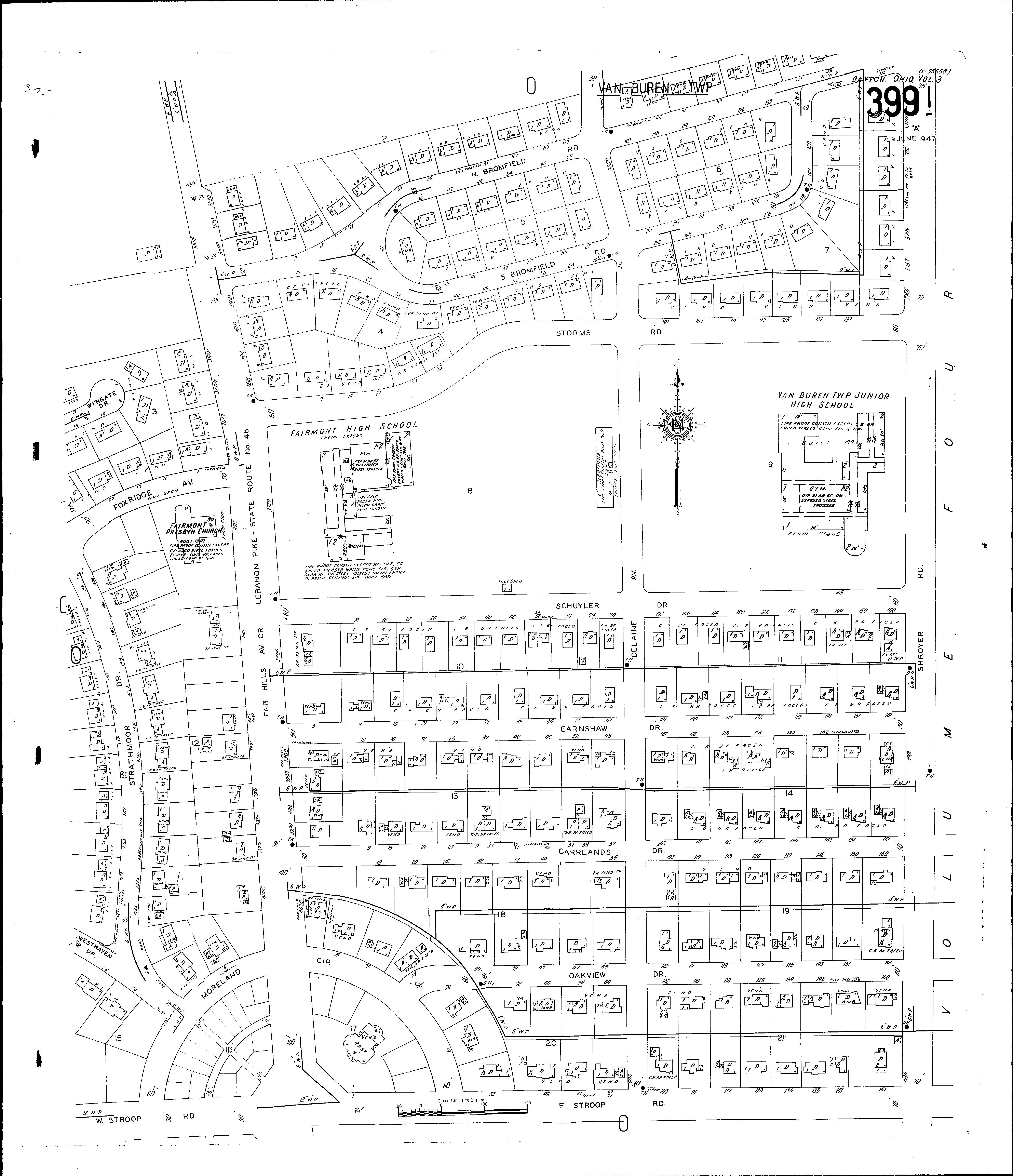
County: Montgomery Co.
City: Dayton
Date: 1918-Dec. 1950 vol. 3, 1918-Nov. 1950
Currently viewing image: 112 of 112
Previous -
NextCurrent sheet label: 399i
Jump to sheet label:
Print map from PDF
Download full image
Download current view
A
full color archival version of this map is available from the Kent State University Institutional Repository.
Locations:Fairmont High School
Fairmont Presbyterian Church
Van Buren Twp. Jr. High School
Streets:Bromfield Road, N [1-212]
Bromfield Road, S [1-150]
Carrlands Drive [1-162]
Delaine Ave [3600-4125]
Earnshaw Drive [1-163]
Far Hills Ave [3500-4025]
Fox Ridge Ave
Lebanon Pike
Moreland Circle
Oakview Drive [21-162]
Schuyler Drive [1-160]
Shroyer Road [3701-4125]
State Route No. 48
Storms Road [1-140]
Strathmoor Drive [3800-3939]
Stroop Road, E [1-161]
Stroop Road, W [1-35]
Westhaven Drive
Wyngate Drive