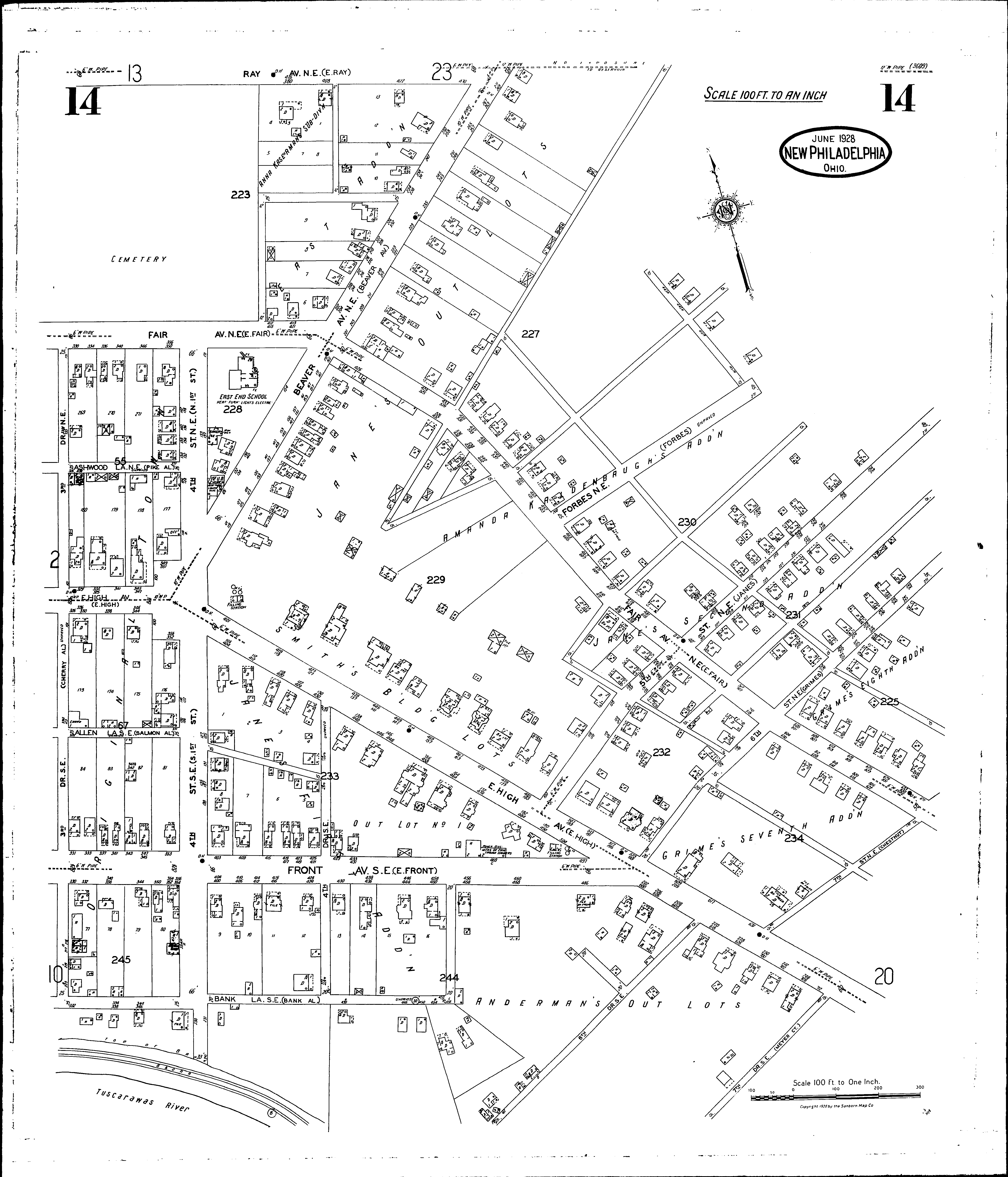
A full color archival version of this map is available from the Kent State University Institutional Repository.
Locations: East End School First U. B. Church
Streets: Allen Lane S. E [326-371] Ashwood Lane N. E [326-371] Bank Lane S. E [332-457] Beaver Ave. N. E [100-269] Beaver Ave. N. E [301-303] Fair Ave. N. E [330-671] Fifth St. N. E [100-271] Forbes N. E [200-271] Fourth Drive S. E [100-231] Fourth St. N. E [100-171] Fourth St. S. E [100-241] Front Ave. S. E [330-497] High Ave., E [326-631] High Ave., E [700-712] Ray Ave. N. E [380-470] Seventh Drive S. E [100-124] Seventh St. N. E [100-170] Sixth Drive S. E [100-171] Sixth St. N. E [100-271] Third Drive N. E [101-171] Third Drive S. E [101-223]
Additions: Andermans Out Lots East Addition Grimes Seventh Addition Grimes Eighth Addition Janes First Addition Janes Second Addition Janes Out Lots Kaldenbaughs, Amanda, Addition Kaserman, Anna, Subdivision Smiths Building Lots