A full color archival version of this map is available from the Kent State University Institutional Repository.
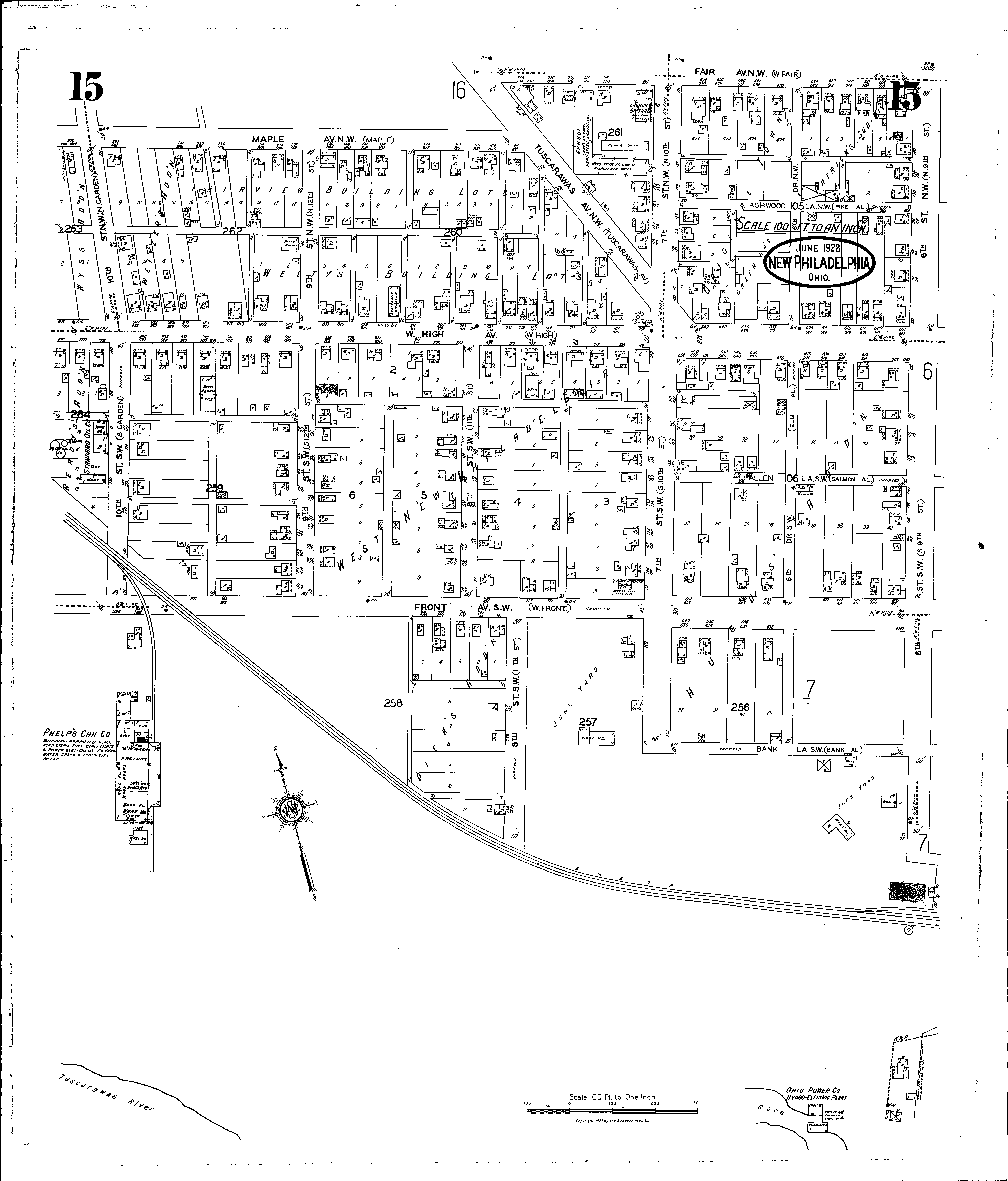
Locations: Church of the Brethren Ohio Power Co., Hydro-electric Plant Phelps Can Co Seventh Day Adventist Church Standard Oil Co
Streets: Allen Lane S. W [600-671] Ashwood Lane N. W [600-671] Bank Lane S. W [600-630] Bank Lane S. W [633-672] Eighth St. S. W [100-235] Fair Ave. N. W [600-734] Front Ave. S. W [601-631] Front Ave. S. W [632-771] High Ave., W [600-1021] Maple Ave. N. W [800-1004] Ninth N. W [100-171] Ninth S. W [100-171] Seventh St. N. W [100-171] Seventh St. S. W [100-231] Sixth Drive N. W [100-171] Sixth Drive S. W [100-171] Sixth Drive S. W [200-230] Sixth St. N. W [100-170] Sixth St. S. W [100-150] Tenth N. W [100-171] Tenth S. W [100-171] Tuscarawas Ave. N. W [100-201]
Additions: Dicks Addition Fairview Building Lots Patricks Subdivision Sweitzers Addition Weltys Building Lots West New Philadelphia Wyss Addition