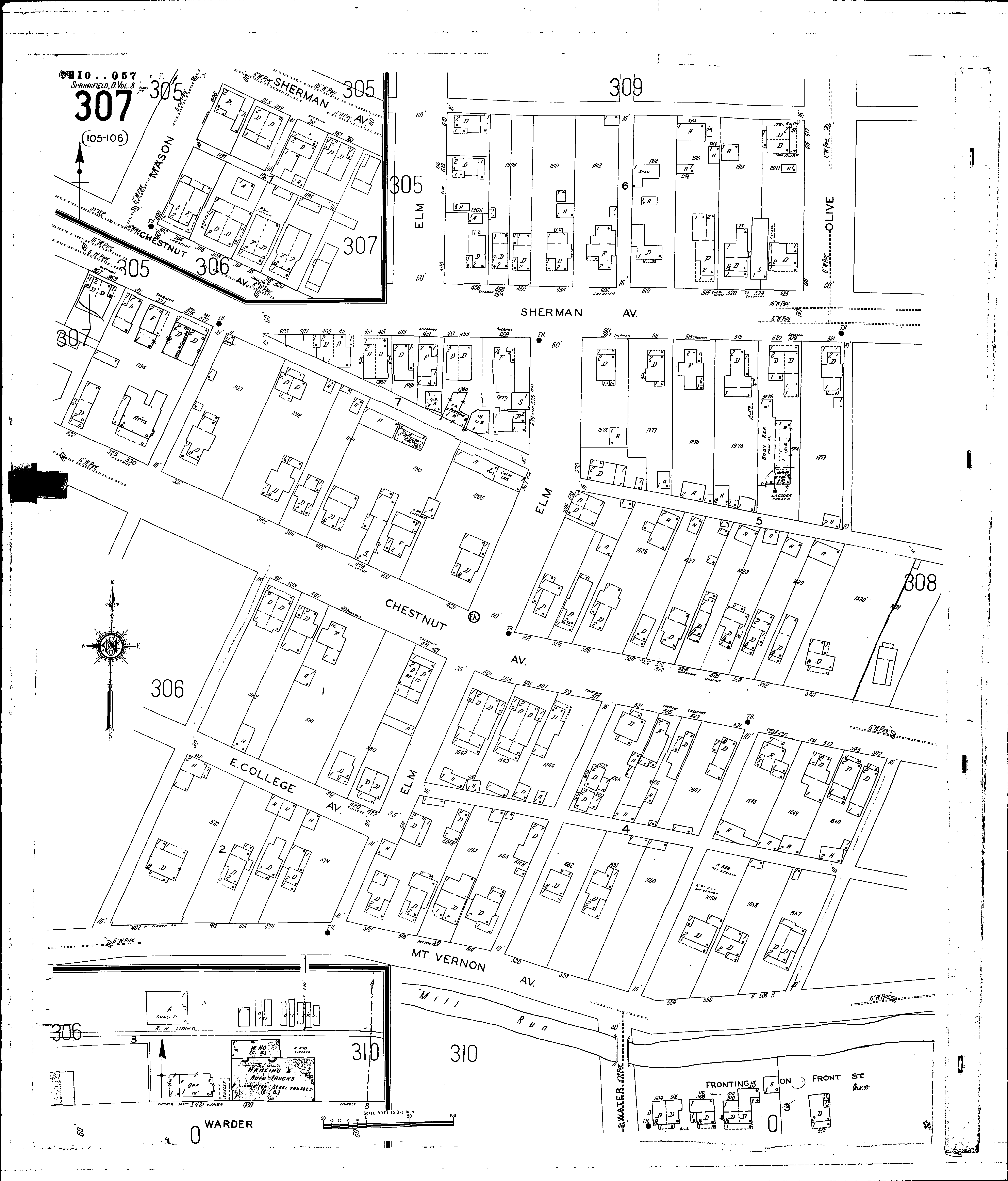
County: Clark Co.
City: Springfield
Date: 1928-Aug. 1950 vol. 2, 1928-Aug. 1950
Currently viewing image: 75 of 96
Previous -
NextCurrent sheet label: 307
Print map from PDF
Download full image
Download current view
A
full color archival version of this map is available from the Kent State University Institutional Repository.
Streets:Warder [400-436]
Chestnut Ave [300-346]
Chestnut Ave [400-541]
Chestnut Ave [543-547]
College, E [400-425]
Elm [514-585]
Elm [600-620]
Front [500-524]
Mason [600-606]
Mt. Vernon Ave [400-501]
Mt. Vernon Ave [502-530]
Mt. Vernon Ave [540-567]
Olive [601-617]
Sherman Ave [355-415]
Sherman Ave [416-531]