County: Clark Co.
City: Springfield
Date: 1928-Aug. 1950 vol. 2, 1928-Aug. 1950
Currently viewing image: 87 of 96
Previous -
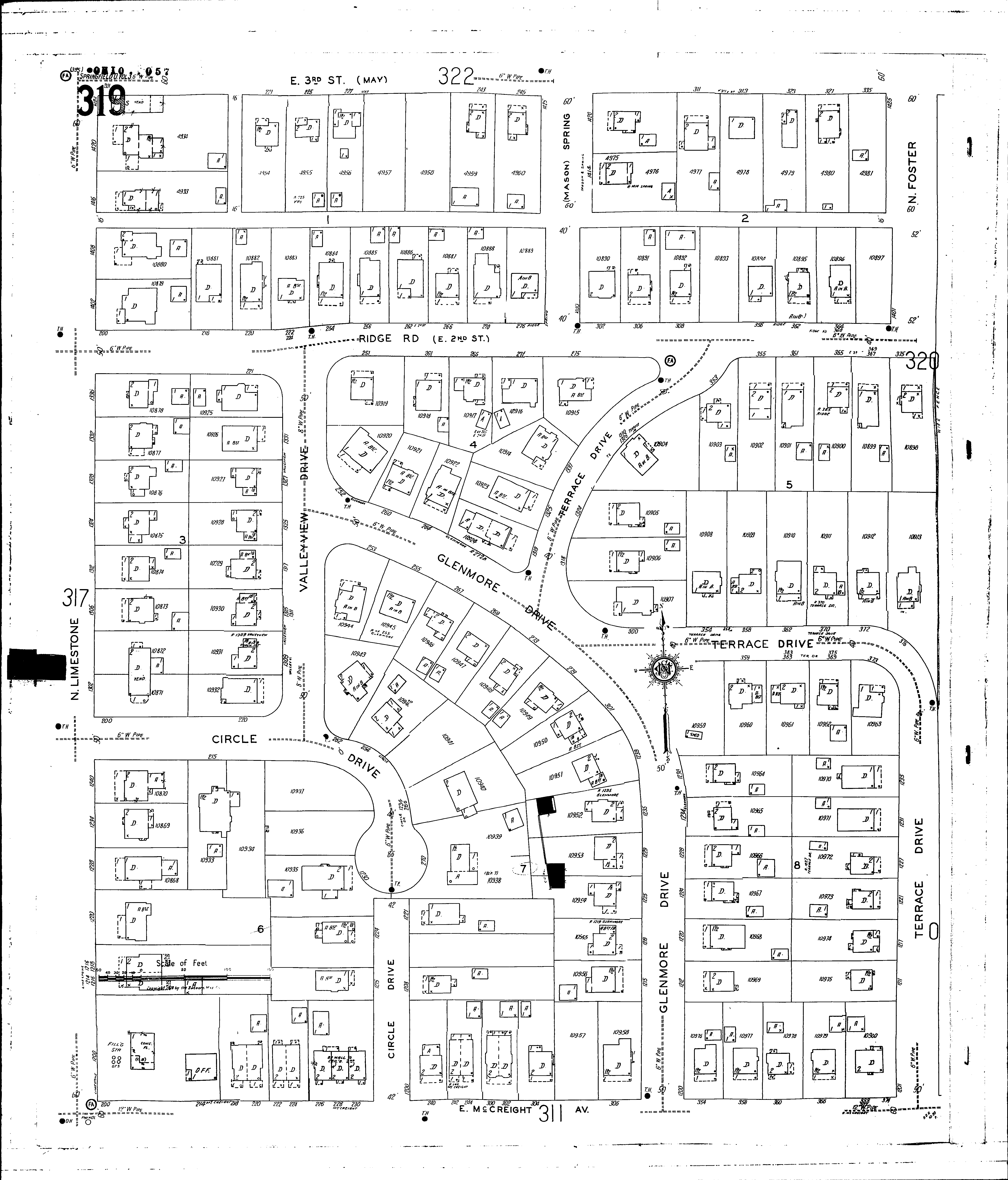
NextCurrent sheet label: 319
Print map from PDF
Download full image
Download current view
A
full color archival version of this map is available from the Kent State University Institutional Repository.
Streets:Circle Drive [222-271]
Third, E [201-335]
Circle Drive [200-221]
Circle Drive [1200-1235]
Foster, N [1401-1425]
Glenmore Drive [252-301]
Glenmore Drive [1200-1239]
Limestone, N [1200-1424]
McCreight Ave., E [200-374]
Mason [1400-1425]
May [301-335]
Ridge Road [200-375]
Spring [1400-1425]
Terrace Drive [300-375]
Terrace Drive [1201-1235]
Terrace Drive [1300-1345]
Valleyview [1300-1335]