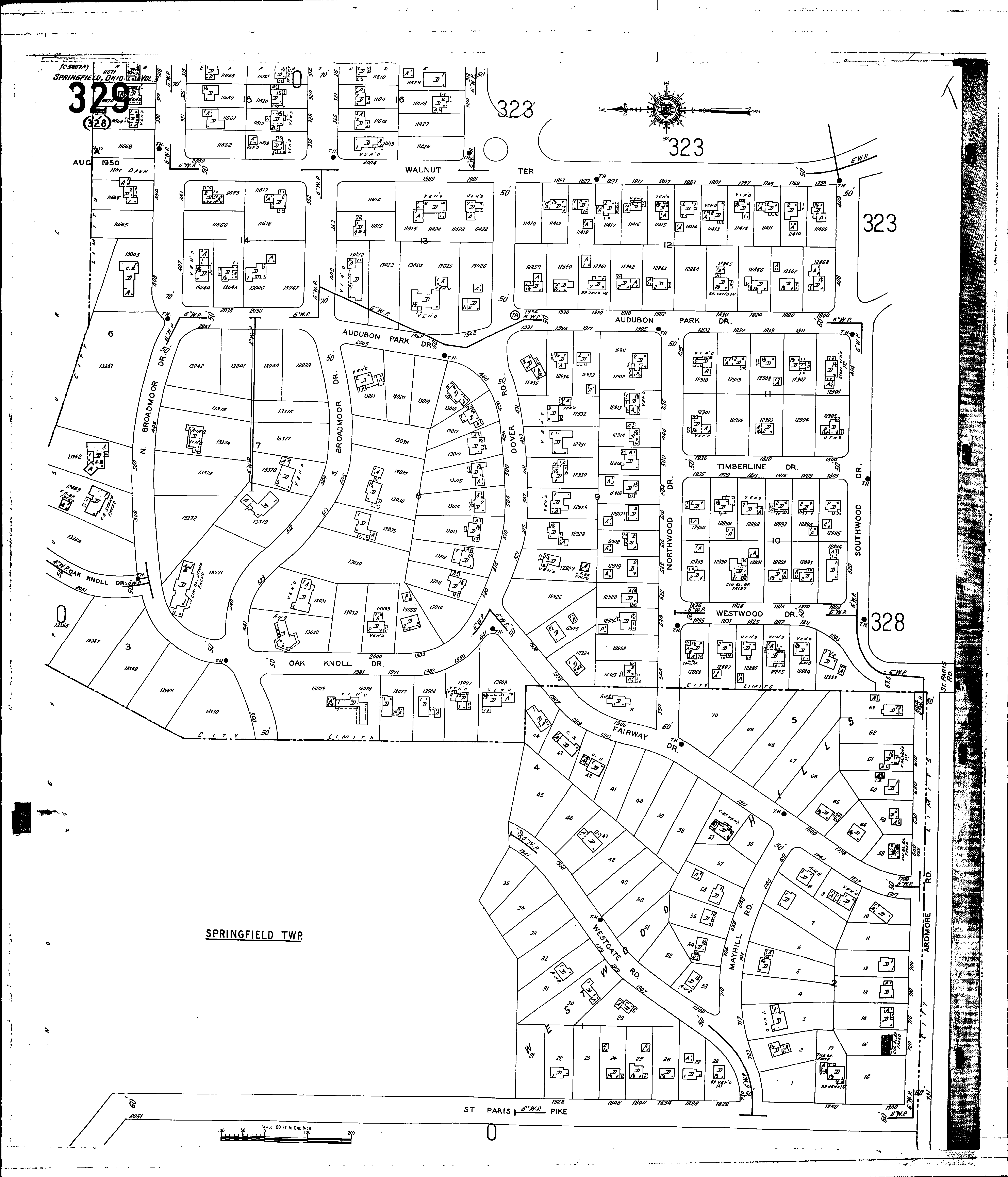
County: Clark Co.
City: Springfield
Date: 1928-Aug. 1950 vol. 2, 1928-Aug. 1950
Currently viewing image: 97 of 96
PreviousCurrent sheet label: 329
Print map from PDF
Download full image
Download current view
A
full color archival version of this map is available from the Kent State University Institutional Repository.
Streets:Ardmore Road [600-730]
Audubon Park [1800-2051]
Broadmoor Drive, N [300-545]
Broadmoor Drive, S [300-545]
Doyer Road
Fairway Drive [1700-1939]
Mayhill Road [650-731]
Northwood Drive [425-550]
Oak Knoll Drive [1940-2051]
St. Paris Pike [1700-2050]
Southwood Drive [400-520]
Timberline Drive [1800-1837]
Walnut Terrace [1751-1835]
Walnut Terrace [1900-2051]
Westgate Road [1900-1945]
Additions:Westwood Hills