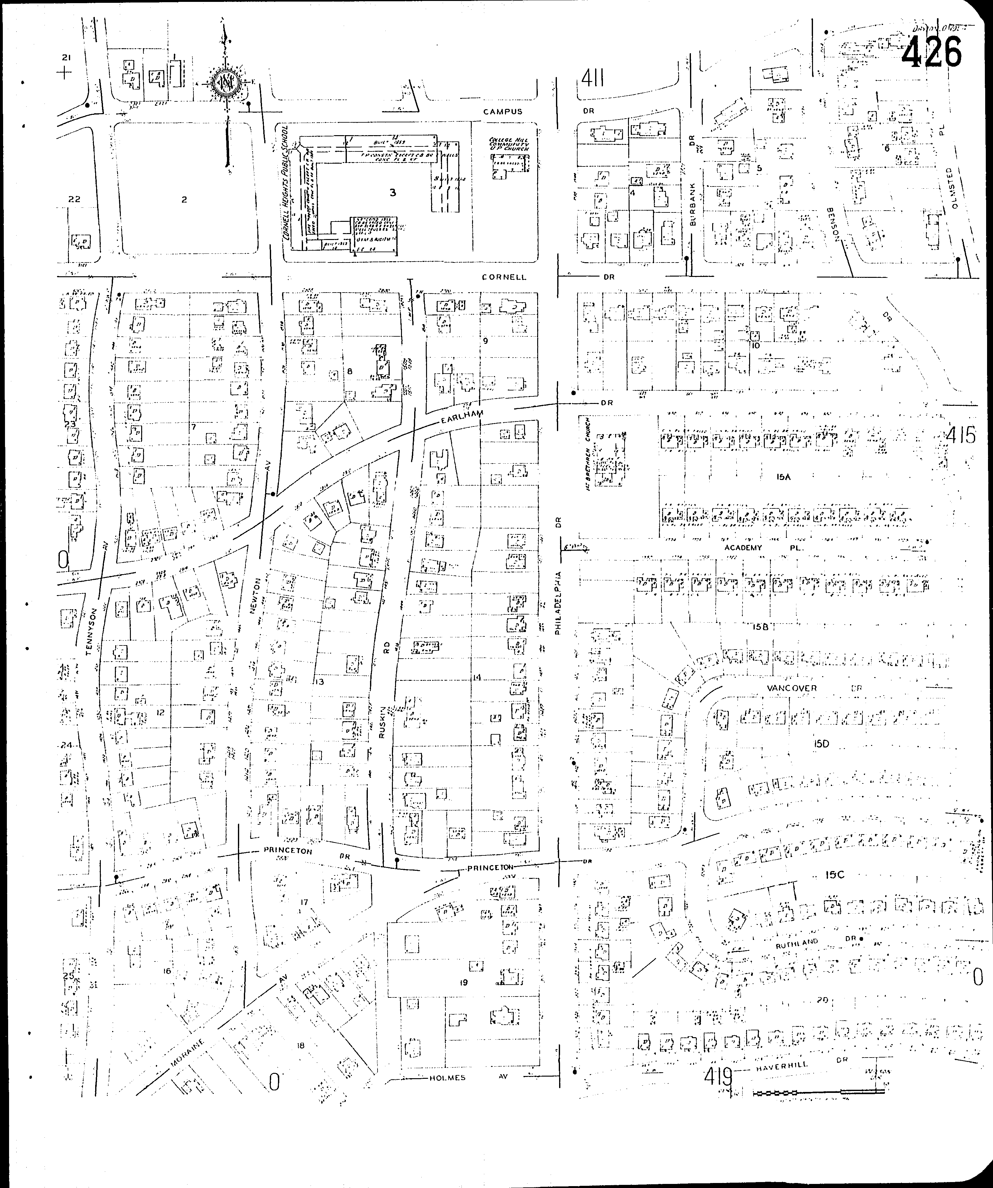
County: Montgomery Co.
City: Dayton
Date: 1918-1956 vol. 4, 1932 Republished 1955
Currently viewing image: 32 of 77
Previous -
NextCurrent sheet label: 426
Print map from PDF
Download full image
Download current view
Locations:College Hill Community U. P. Church
Cornell Heights Public School
First Brethren Church, Philadelphia Drive
Streets:Academy Place [1716-1799]
Benson Drive [1455-1487]
Benson Drive [1500-1555]
Burbank Drive [1500-1529]
Campus Drive [1570-2914]
Campus Drive [2916-3021]
Cornell Drive [1600-3103]
Earlham Drive [1600-3005]
Everett Drive [1313]
Haverhill Drive [1801-1943]
Holmes Ave [2701-2745]
Moraine Ave [2800-2919]
Newton Ave [1300-1559]
Olmsted Place [1501-1549]
Philadelphia Drive [1328-1559]
Princeton Drive [1708-2921]
Ruskin Road [1300-1525]
Ruthland Drive [1800-1885]
Tennyson Ave [1300-1715]
Vancover Drive [1716-1799]