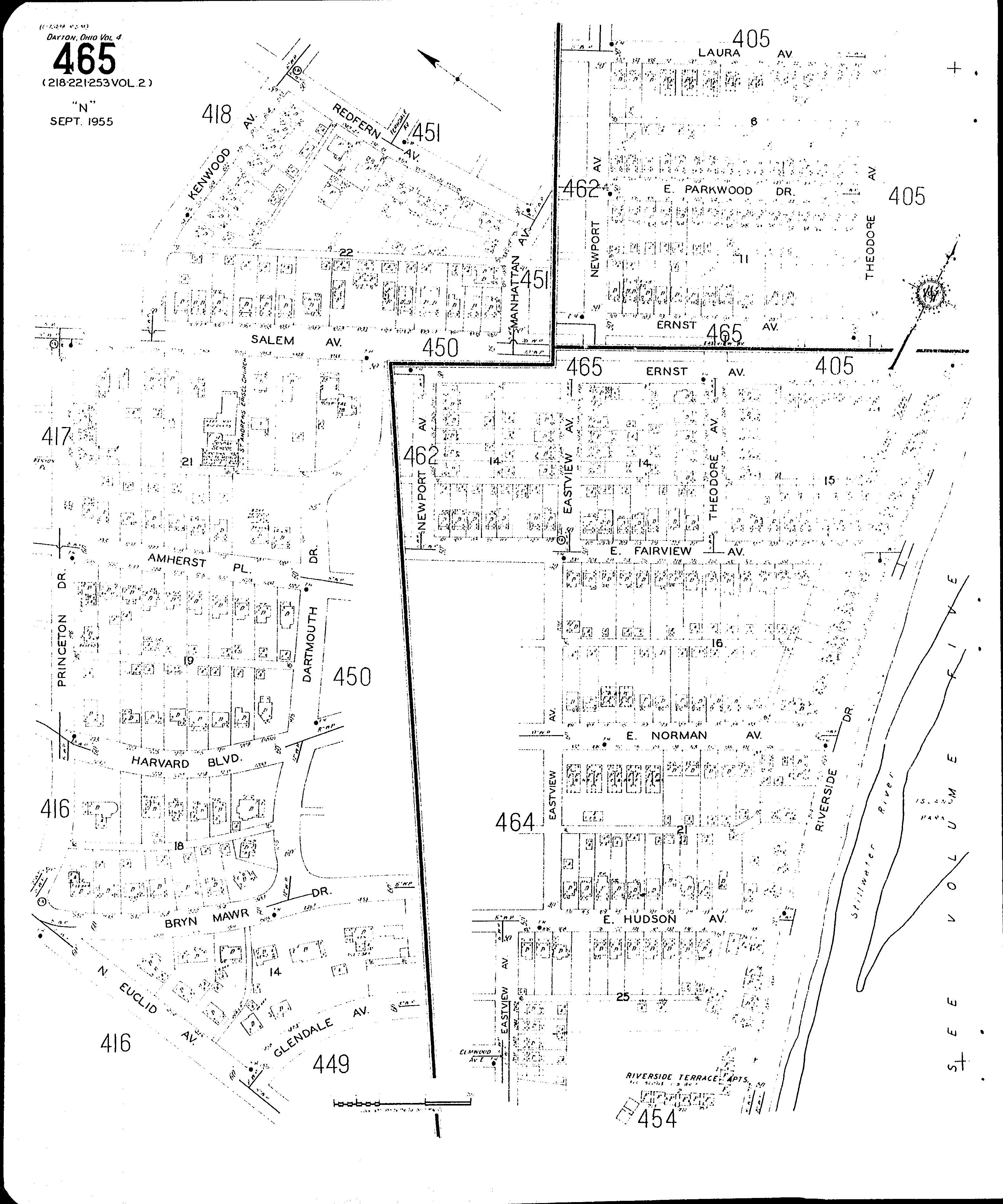
County: Montgomery Co.
City: Dayton
Date: 1918-1956 vol. 4, 1932 Republished 1955
Currently viewing image: 71 of 77
Previous -
NextCurrent sheet label: 465
Print map from PDF
Download full image
Download current view
Locations:St. Andrews Episcopal Church
Streets:Amherst Place [1200-1239]
Bryn Mawr Drive [1451-1465]
Bryn Mawr Drive [1466-1553]
Dartmouth Drive [801-1019]
Eastview Ave [2034-2234]
Eastview Ave [2300-2339]
Ernst Ave [100-219]
Ernst Ave [300-340]
Euclid Ave., N [1430-1460]
Fairview Ave., E [101-129]
Fairview Ave., E [200-333]
Glendale Ave [1446-1460]
Harvard Boulevard [1200-1235]
Hudson Ave., E [100-449]
Kenwood Ave [600-656]
Laura Ave [100-160]
Manhattan Ave [1001-1019]
Newport Ave [2300-2516]
Norman Ave., E [100-155]
Parkwood Drive, E [100-165]
Princeton Drive [800-1020]
Redfern Ave [1001-1053]
Riverside Drive [1953-2333]
Salem Ave [1001-1035]
Salem Ave [1036-1079]
Salem Ave [1100-1118]
Theodore Ave [2300-2331]
Theodore Ave [2401-2519]