County: Hamilton Co.
City: Cincinnati
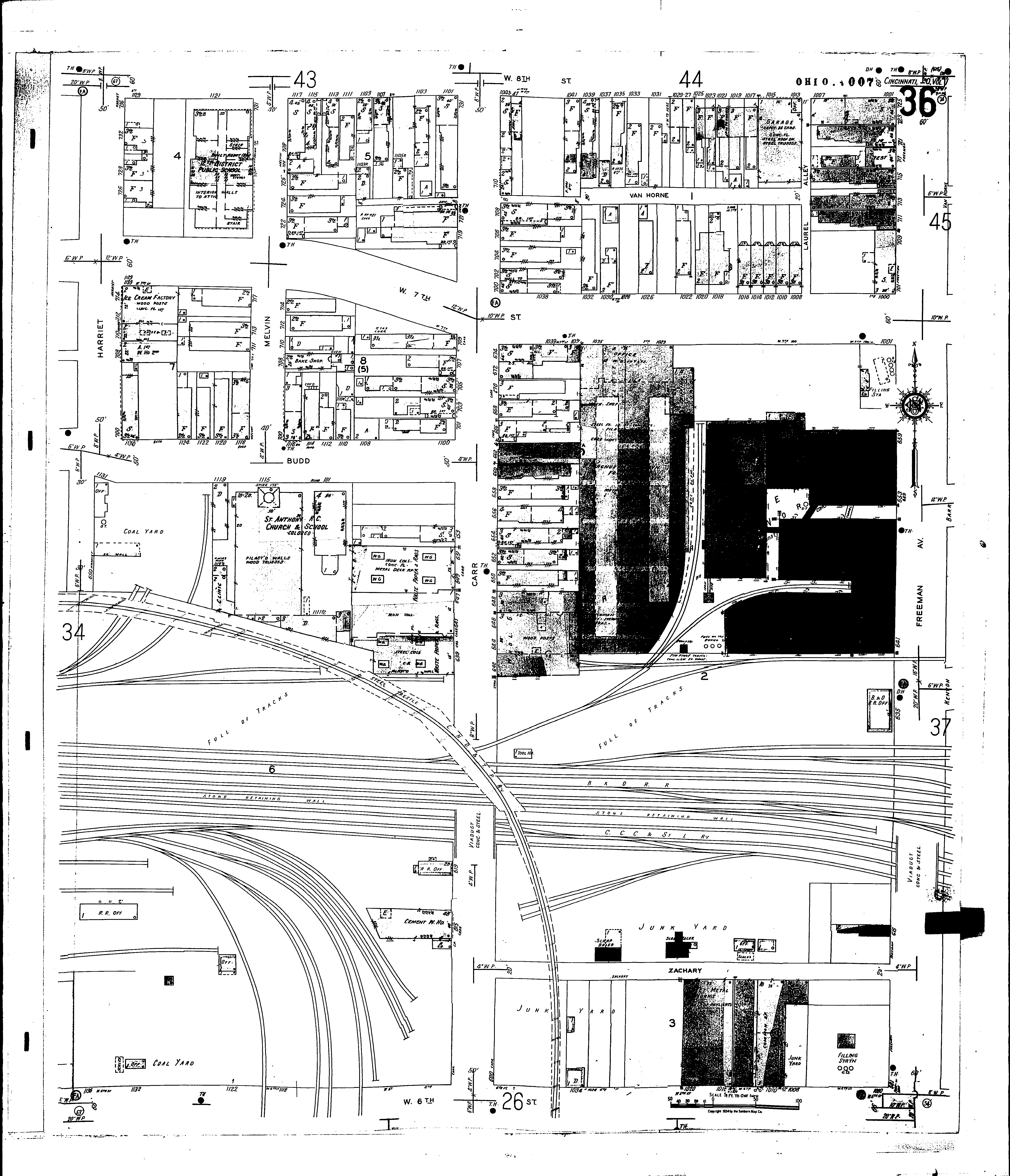
Date: 1904-June 1950 vol. 1,1934-Apr. 1950
Currently viewing image: 41 of 88
Previous -
NextCurrent sheet label: 36
Jump to sheet label:
Print map from PDF
Download full image
Download current view
A
full color archival version of this map is available from the Kent State University Institutional Repository.
Locations:St. Anthony R. C. Church & School (col.)
National Lead Co
St. Antonius R. C. Church and School
Twelfth District Public School
Streets:Carr [600-731]
Eighth, W [1001-1133]
Freeman Ave [601-725]
Harriet [650-736]
Laurel Alley
Melvin [700-731]
Seventh, W [1000-1129]
Sixth, W [1000-1136]
Van Horne
Zachary