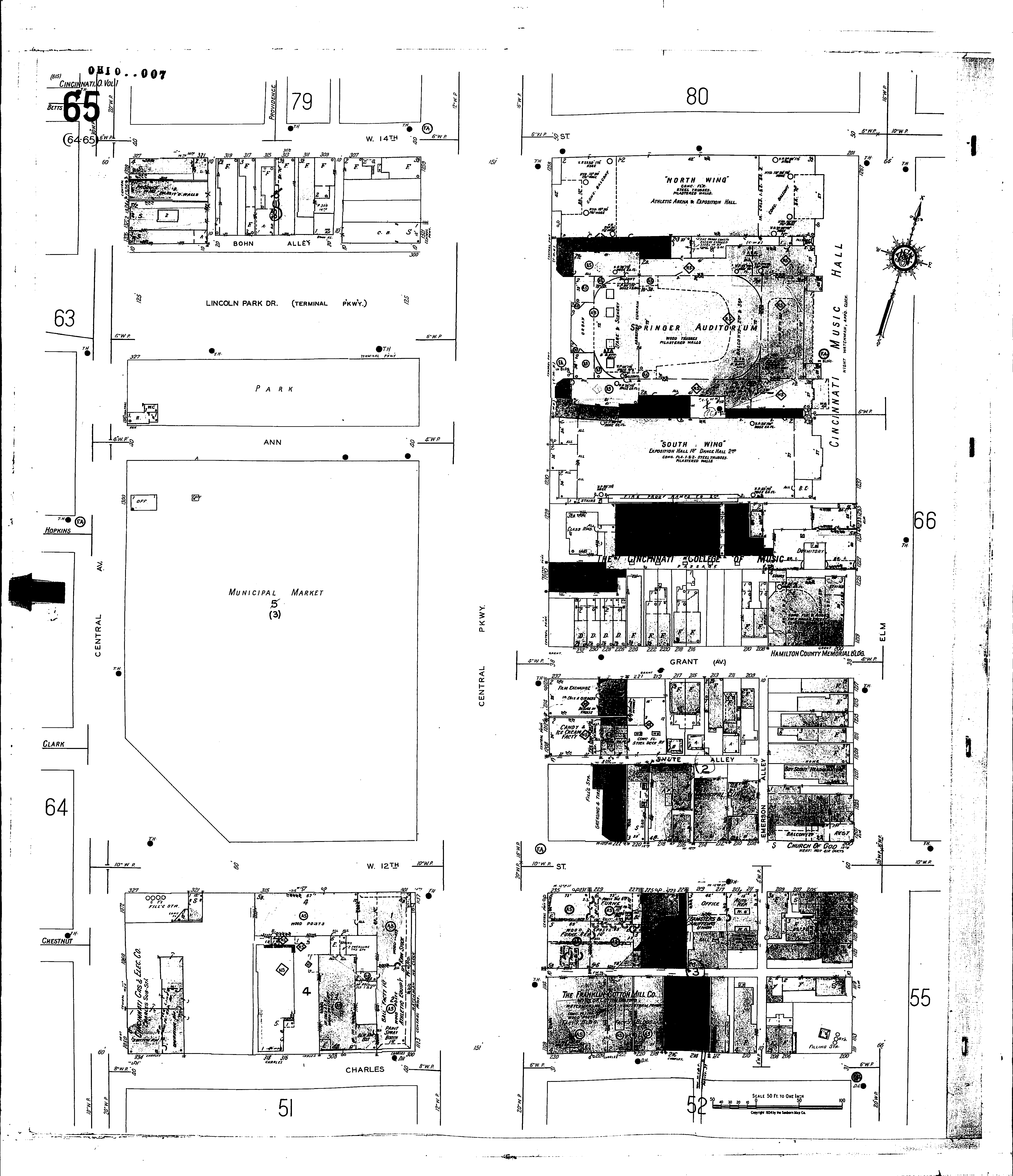
A full color archival version of this map is available from the Kent State University Institutional Repository.
Locations: Municipal Clinic Boy Scout Headquarters Cincinnati College of Music Cincinnati Music Hall Franklin Cotton Mill Co Hamilton County Memorial Building St. Johns Unitarian Church Strietmann Biscuit Co Teamsters and Chauffeurs Union Y. M. C. A., Annex
Streets: Lincoln Park Drive [300-329] Ann Bohn Alley Central Ave [1050-1328] Central Parkway [1108-1120] Central Parkway [1122-1259] Charles [200-334] Elm [1111-1267] Emerson Alley Fourteenth, W [201-327] Grant [200-237] Grant, Ave [200-237] Laurel [300-327] Shute Alley Terminal Parkway [300-327] Twelfth, W [200-327]