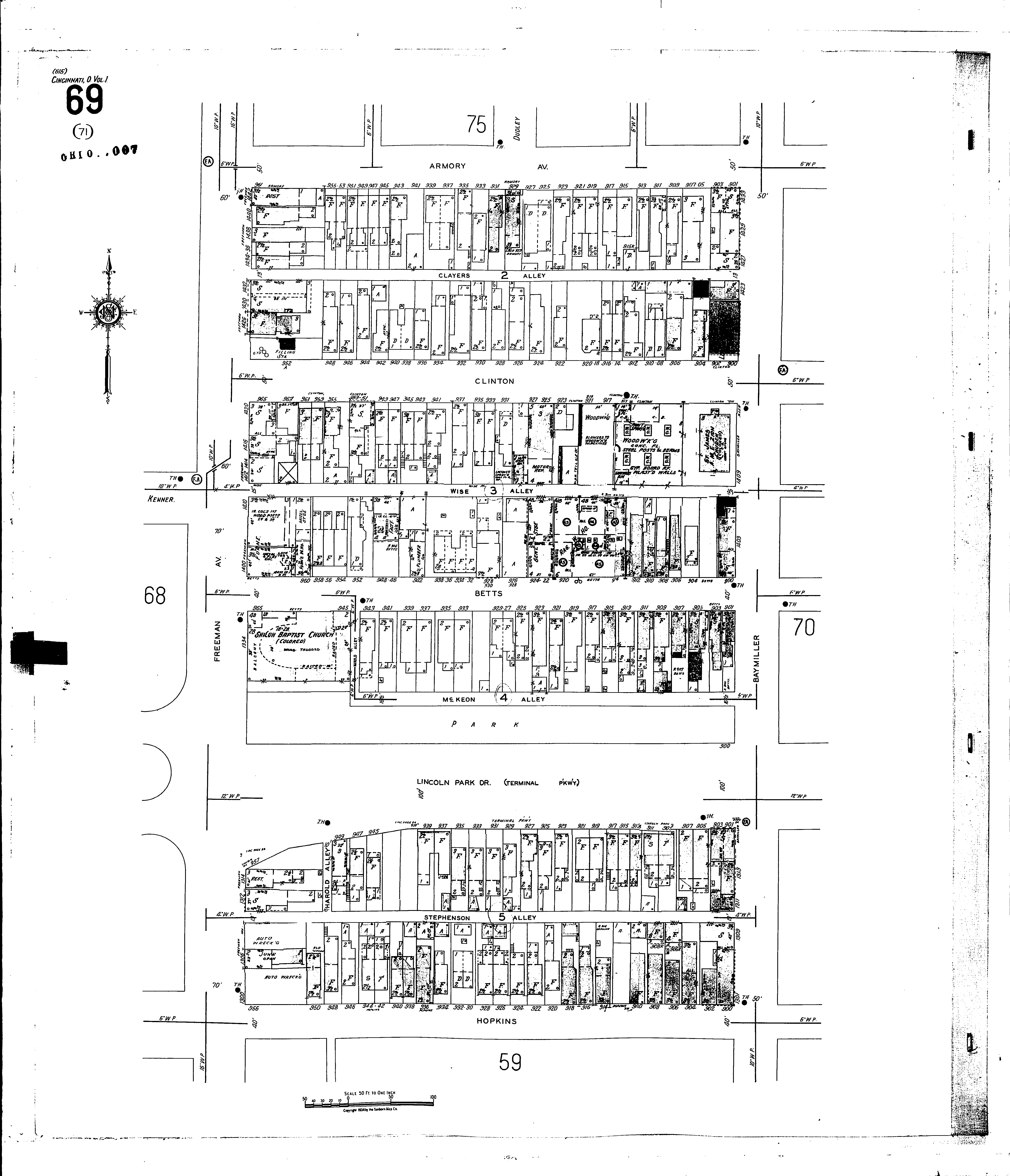
A full color archival version of this map is available from the Kent State University Institutional Repository.
Locations: Immanuel Lutheran Church Shiloh Baptist Church (col.) Betts Street Furniture Co First United Brethren Church Kemper Furniture Co Lincoln Park Baptist Church
Streets: Lincoln Park Drive [900-959] Armory Ave [901-961] Baymiller [1301-1433] Betts [900-969] Clayers Alley Clinton [900-965] Freeman Ave [1300-1442] Harold Alley Hopkins [900-958] McKeon Alley Stephenson Alley Terminal Parkway [900-957] Wise Alley