County: Hamilton Co.
City: Cincinnati
Date: 1904-June 1950 vol. 1,1934-Apr. 1950
Currently viewing image: 87 of 88
Previous -
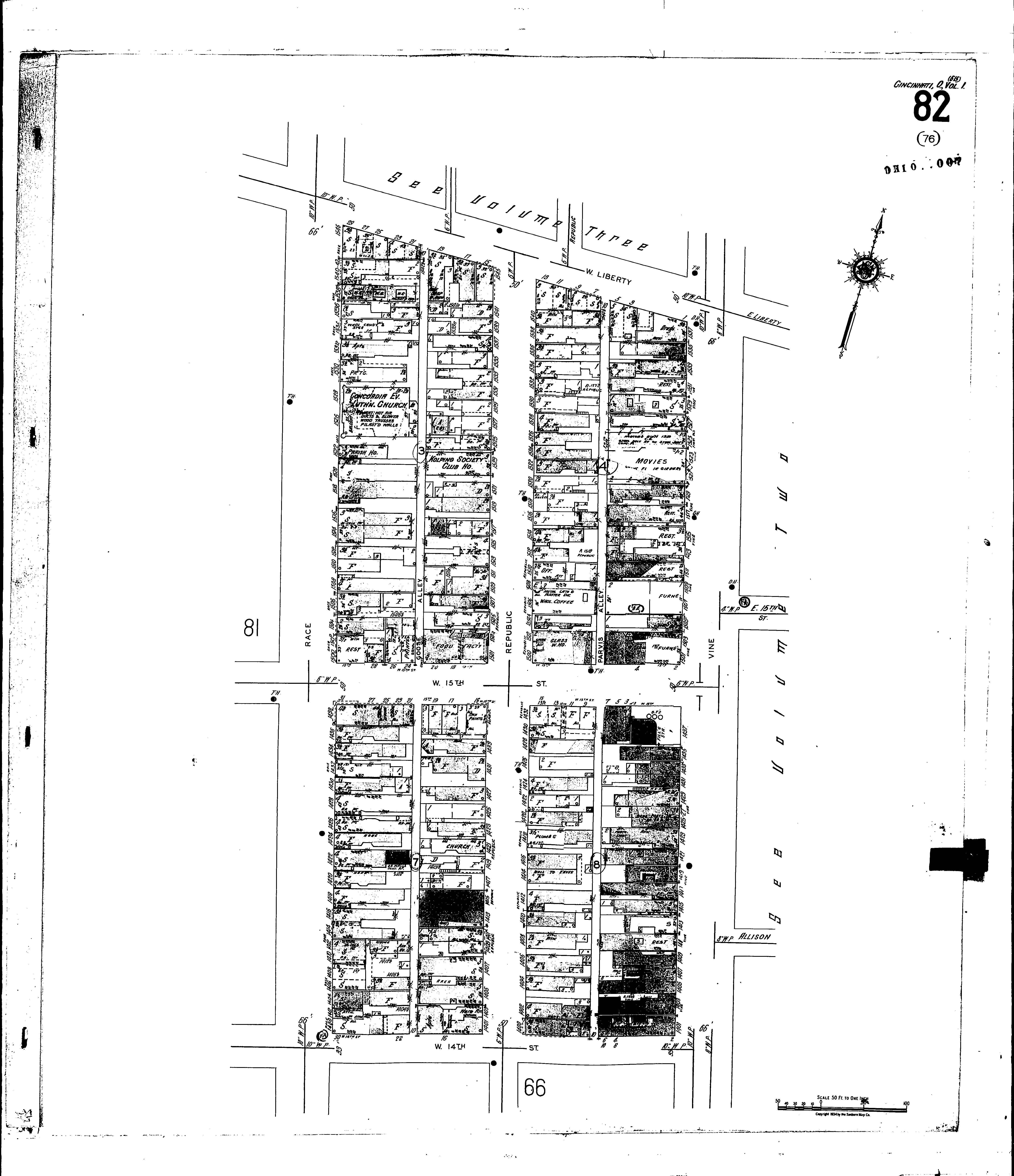
NextCurrent sheet label: 82
Jump to sheet label:
Print map from PDF
Download full image
Download current view
A
full color archival version of this map is available from the Kent State University Institutional Repository.
Locations:Concordia Evangelical Lutheran Church
Kolping Society Club House
Mabley & Carew, Department Store
Zion Evangelical Church
Streets:Fifteenth, W [1-32]
Fourteenth, W [2-30]
Goose Alley
Liberty, W [1-29]
Parvis Alley
Race [1400-1548]
Republic [1400-1545]
Vine [1401-1537]